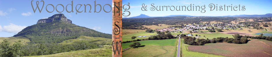
Just a twenty minute drive from Woodenbong you will find the small village of Urbenville.
 Nestled at the foot of the imposing volcanic plug of Coutts Crown Mountain, Urbenville is only 13 km south of Woodenbong. Originally known as Tooloom, the Village was renamed Urbenville after Mr. William Urben who was the first white child born at the Tooloom Gold Diggings. Records show that a post office was established in 1909, a school was set up in 1910 and the village was proclaimed in 1912. In 2010 the Public School held their Centenary celebrations.
Situated in the headwaters of the mighty Clarence River, the numerous streams around Urbenville provide fishing, fossicking, canoeing and swimming opportunities. The area is a biodiversity hot spot, and the National Parks and State Forests that surround the Village are rich in Flora and Fauna.
The Urbenville Progress Association was formed in 1983 to promote and improve the village, encourage tourism and businesses and liaise between the community and Councils as the majority of the village is situated in the Tenterfield Shire, but the showgrounds and bowls club are situated in the Kyogle Shire. The Progress Association manage the local hall, the Forestry Park camping ground, produce the Village News and run events that raise money for local non profit organisations.
Village services and amenities include:
Urbenville Primary School, Hotel, Bowling Club, Medical Practitioner and Hospital Multi Purpose Centre and Aged Care Unit, Ambulance, Police, S.E.S., Fire Brigade, Banking Facilities, General Store and Petrol, Garage/Mechanical Repairs, Post Office/Newsagency, Parks, Camping Grounds, a Showground and Historical Museum. Seniors Day Care and a Northern Rivers Area Health community bus that is shared between Urbenville, Woodenbong and Bonalbo. There are several haulage companies who used to transport the timber in the past and now survive hauling livestock.
Regular events held include Yamaha Trailbike Rides; Rodeo, Country Show, Pony Club.


- Image via Wikipedia

Urbenville is only 26 km south of the Qld/NSW Border. Population: 250 Altitude: 400m
Originally known as Tooloom, the Village was renamed Urbenville after Mr. William Urben who was the first white child born at the Tooloom Gold Diggings.
Situated in the Clean and Green headwaters of the mighty Clarence River, the numerous streams around Urbenville provide fishing, fossicking, canoeing and swimming opportunities. The area is a biodiversity hot spot, and the National Parks and State Forests that surround the Village are rich in Flora and Fauna.
Village services and amenities include:
Urbenville Primary School, Hotel, Bowling Club, Medical Practitioner and Hospital Multi Purpose Centre, Police, S.E.S., Fire Brigade, Post Office, Banking Facilities, General Store and Petrol, Newsagency, Arts & Crafts Shop, Parks and Camping, and Historical Museum.
Distance From:
* Brisbane 150 km
* Lismore 150 km
* Casino 90 km
* Tenterfield 150 km
* Warwick 84 km
Pioneer Cottage Museum
Pioneer Cottage Museum presents the past in an authentic early “Settlers Home”, featuring rooms just as they were when the early Pioneers lived and worked in this rich Farming and Timber country. The Cottage is open on the 2nd Saturday of each month from February to November or by appointment. Phone (02) 6634 1240 or (02) 6635 1381. The Museum welcomes School Excursions (work sheets are available) and other groups. Entry Fee is $2 adults and 50c children.
Tooloom Falls
Just 3km. from Urbenville on the Warwick/Tenterfield Road, turn left for a further 3 km to Tooloom Falls or Dooloomi, a beautiful and fitting climax to your journey into legend. Tooloom Falls is one of the most significant sites in Gidabal country because of the many legendary stories of their aboriginal tribal belief. Tooloom Falls was declared an Aboriginal Place in 1977 under the National Parks & Wildlife Act. This recognises, and legally protects the site, but does not change the land status, which remains a public reserve, camping permitted.
Coutts Crown Mountain (North Obelisk 728m)
Situated on the south/west outskirts of Urbenville accessible for bush walking and rock climbing.
Edinburgh Castle Mountain (893m)
Situated off Boomi Rd., North East of Urbenville is accessed through private property on permission.
Tooloom National Park and Lookout
On the Warwick/Tenterfield Rd. Picnic facilities and bush-walking trails at the peak of the Koreelah Range with views that are really something to see.
The Nightcap Mountain (671m)
Situated north west of Urbenville off Woodenbong Rd., or Beaury Creek Rd., access through private property.
Billy May’s Point
Here you will find the old shafts and workings of the the historic Tooloom Gold Fields dating from the 1880’s. Following the fence line up the ridge you will find the old Cemetery. Permission to camp is required from the property owners.
Historical Tank Traps
Large concrete pyramids can be found on the banks of the Clarence at Paddys Flat. These blocks, designed to stop tank movements, were set along the river during World War 2 in the fear of the Japanese passing the QLD border.
Callawajune (the Beehive) Mountain (South Obelisk 840m)
Situated south of the Tooloom Falls access through State Forest – bush walking and rock climbing a great adventure.
Town Guide http://www.nnsw.com.au/urbenville/
Mountain Climbing Guide
http://www.immortal.net.au/climbing/guides/thecrown/thecrown.html